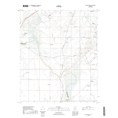
2018 Map of Collinston West
USGS Topo · Published 2018About this map
Wham Brake and the extensive wetlands of Morehouse Parish define this landscape, where the flat alluvial plains are crisscrossed by a complex network of bayous and drainage channels. The map captures a rural territory south of Bastrop, anchored by small communities such as Spyker, Upland, and Wham. Of particular interest to genealogists are the numerous family-linked burial grounds, including the Pickett Family Cem and Carter Cem, which provide clues to the early landholders in this portion of Louisiana. The transition between the wet brakes, such as Millhaw Brake and Calhoun Brake, and the cultivated agricultural lands is marked by a winding road system, including the historical corridor of Old Monroe Rd. Further south, Windsor and Collinston appear at the edges of the survey, where Staulkinghead Cr and Mill Bayou wind through the terrain.
Find a feature on this map
68 named features on this map. Tap any name to fly to it.
Don’t see what you’re looking for? This feature index may not catch every label — zoom into the map to look around manually.
Map Details
Editions of this 2018 Collinston West Map
This is the sole edition of this map. No revisions or reprints were ever made.
Other maps of this area

1935 · Collinston
USGS Topo · 1:62,500

1935 · Naff
USGS Topo · 1:62,500

1935 · Drew
USGS Topo · 1:62,500

1935 · Haile
USGS Topo · 1:62,500

1955 · Jackson
USGS Topo · 1:250,000

1955 · Shreveport
USGS Topo · 1:250,000

1956 · Shreveport
USGS Topo · 1:250,000

1956 · Bastrop
USGS Topo · 1:62,500

1956 · Haile
USGS Topo · 1:62,500

1957 · Monroe North
USGS Topo · 1:62,500