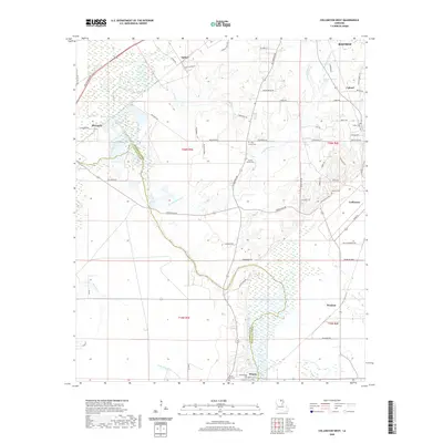
2020 Map of Collinston West
USGS Topo · Published 2020About this map
Collinston and the rural stretches of Morehouse Parish define this landscape, where agricultural fields meet the complex wetlands of the Louisiana backcountry. The map traces the boundary between Morehouse and Ouachita Parishes as it winds through a network of bayous and brakes, including the significant Wham Brake and Mayhaw Brake. Small, established settlements like Spyker, Marcarco, and Windsor are scattered across the terrain, connected by a grid of parish roads that follow the rise and fall of the local topography. For those researching family history, the map identifies several local burial sites such as Pine Grove Cem, Pickett Family Cem, and Wham Ridge Cem. Water is a constant presence, with Staulkinghead Cr, Jordan Cr, and Stink Creek threading through the lower-lying areas, illustrating the drainage patterns that have historically shaped land use and settlement in this part of the Mississippi Delta region.
Find a feature on this map
69 named features on this map. Tap any name to fly to it.
Don’t see what you’re looking for? This feature index may not catch every label — zoom into the map to look around manually.
Map Details
Editions of this 2020 Collinston West Map
This is the sole edition of this map. No revisions or reprints were ever made.
Other maps of this area

1935 · Collinston
USGS Topo · 1:62,500

1935 · Naff
USGS Topo · 1:62,500

1935 · Drew
USGS Topo · 1:62,500

1935 · Haile
USGS Topo · 1:62,500

1955 · Jackson
USGS Topo · 1:250,000

1955 · Shreveport
USGS Topo · 1:250,000

1956 · Shreveport
USGS Topo · 1:250,000

1956 · Bastrop
USGS Topo · 1:62,500

1956 · Haile
USGS Topo · 1:62,500

1957 · Monroe North
USGS Topo · 1:62,500