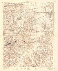
1937 Map of Collinsville
USGS Topo · Published 1937About this map
Collinsville serves as the industrial and population anchor of this mid-1930s landscape, situated where the Pennsylvania railroad and the electric Illinois Terminal lines intersect. The map illustrates a rural society organized around small crossroads and family-centered landmarks, particularly the high density of rural schoolhouses like Clay Sch, Standard Sch, and Liberty Sch. These small district schools, along with the numerous Cem (cemeteries) noted near Troy and Maryville, provide vital evidence of early 20th-century neighborhood structures before the consolidation of the postwar era.
Find a feature on this map
35 named features on this map. Tap any name to fly to it.
Don’t see what you’re looking for? This feature index may not catch every label — zoom into the map to look around manually.
Map Details
Editions of this 1937 Collinsville Map
2 editions found

Other maps of this area

1888 · St. Louis
USGS Topo · 1:62,500

1907 · Belleville
USGS Topo · 1:62,500

1927 · Alton
USGS Topo · 1:62,500

1927 · Edwardsville
USGS Topo · 1:62,500

1931 · French Village
USGS Topo · 1:24,000

1932 · Edwardsville
USGS Topo · 1:62,500

1934 · Alton
USGS Topo · 1:62,500

1935 · Lebanon
USGS Topo · 1:24,000

1935 · French Village
USGS Topo · 1:24,000

1935 · Monks Mound
USGS Topo · 1:24,000