
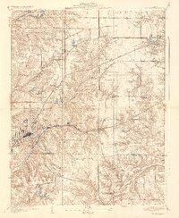
1937 Map of Collinsville
USGS Topo · Published 1937About this map
Collinsville sits at the heart of this 1930s industrial and agricultural landscape, where the dense grid of the city meets the irregular topography of the Illinois bluffs. The map captures a sophisticated transportation network during a decade of transition, featuring the extensive tracks of the Illinois Terminal and the Pennsylvania railroad lines which facilitated the region's coal and manufacturing output. Outside the main city center, a constellation of rural schools such as Wilson Heights Sch, Clay Sch, and Liberty Sch suggests a well-distributed population of farming and mining families.
Find a feature on this map
33 named features on this map. Tap any name to fly to it.
Don’t see what you’re looking for? This feature index may not catch every label — zoom into the map to look around manually.
Map Details
Editions of this 1937 Collinsville Map
2 editions found
Other maps of this area

1888 · St. Louis
USGS Topo · 1:62,500

1907 · Belleville
USGS Topo · 1:62,500

1927 · Alton
USGS Topo · 1:62,500

1927 · Edwardsville
USGS Topo · 1:62,500

1931 · French Village
USGS Topo · 1:24,000

1932 · Edwardsville
USGS Topo · 1:62,500

1934 · Alton
USGS Topo · 1:62,500

1935 · Lebanon
USGS Topo · 1:24,000

1935 · French Village
USGS Topo · 1:24,000

1935 · Monks Mound
USGS Topo · 1:24,000