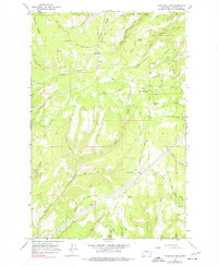
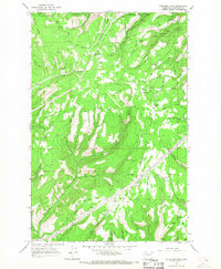
1966 Map of Colockum Pass
USGS Topo · Published 1979About this map
Wenatchee National Forest spans this high-elevation landscape in the mid-1960s, defined by the drainage systems of Naneum Creek and Colockum Creek. This region is a network of ridges and canyons, where the remote settlement of Mountain Home and the Naneum Airstrip provided critical outposts for land management and local navigation. The terrain is marked by prominent crossings and features like Colockum Pass and Trough Springs, which have long served as essential waypoints through the rugged divide between the Kittitas and Wenatchee areas. A complex system of transit, including the Colockum Road and several Pack Trails, illustrates the 20th-century reliance on both motorized and traditional travel across Jumpoff Ridge and Naneum Ridge. A prominent Pipeline corridor also traverses the southeastern quadrant, showing the integration of infrastructure into this remote forested area.
Find a feature on this map
30 named features on this map. Tap any name to fly to it.
Don’t see what you’re looking for? This feature index may not catch every label — zoom into the map to look around manually.
Map Details
Editions of this 1966 Colockum Pass Map
3 editions found
Other maps of this area

1912 · Malaga
USGS Topo · 1:48,000

1913 · Wenatchee
USGS Topo · 1:62,500

1914 · Malaga
USGS Topo · 1:62,500

1915 · Wenatchee
USGS Topo · 1:62,500

1920 · Colockum Pass
USGS Topo · 1:125,000

1922 · Colockum Pass
USGS Topo · 1:125,000

1957 · Wenatchee
USGS Topo · 1:250,000
1966 · Colockum Pass SW
USGS Topo · 1:24,000
1966 · Colockum Pass SE
USGS Topo · 1:24,000
1966 · Colockum Pass
USGS Topo · 1:24,000