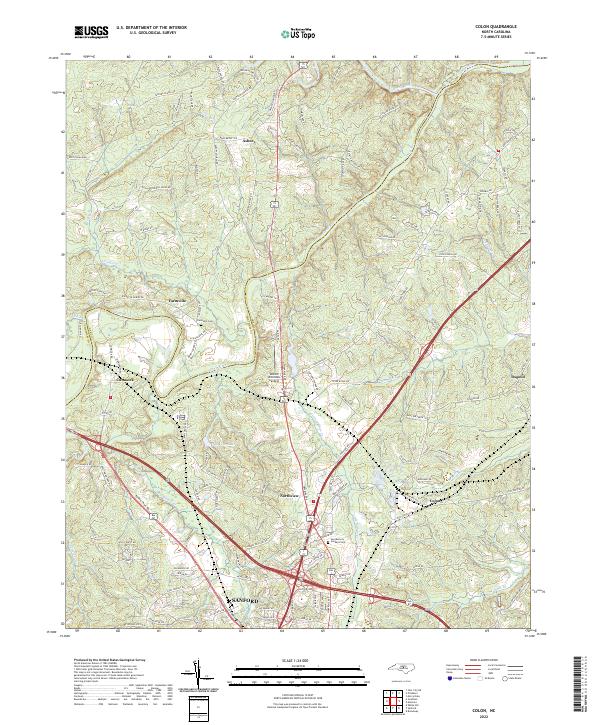
2022 Map of Colon
USGS Topo · Published 2022About this map
The Deep River and Rocky River converge in this northern section of Lee County, defining a landscape of winding watercourses and historical settlements. Along the southern edge, the growth of Sanford is evident, while smaller communities like Cumnock, Farmville, and Colon dot the surrounding countryside. This contemporary topographic record captures the area's transition from rural riverbanks to expanding residential and commercial centers, with features such as Sky View Lake and Moretz Riverside Landing marking the local topography.
Find a feature on this map
121 named features on this map. Tap any name to fly to it.
Don’t see what you’re looking for? This feature index may not catch every label — zoom into the map to look around manually.
Map Details
Editions of this 2022 Colon Map
This is the sole edition of this map. No revisions or reprints were ever made.
Other maps of this area

1953 · Raleigh
USGS Topo · 1:250,000

1954 · Raleigh
USGS Topo · 1:250,000

1969 · New Hope Dam
USGS Topo · 1:24,000

1970 · Goldston
USGS Topo · 1:24,000

1970 · Pittsboro
USGS Topo · 1:24,000

1970 · Colon
USGS Topo · 1:24,000

1970 · Moncure
USGS Topo · 1:24,000

1970 · Siler City NE
USGS Topo · 1:24,000

1974 · White Hill
USGS Topo · 1:24,000

1974 · Sanford
USGS Topo · 1:24,000