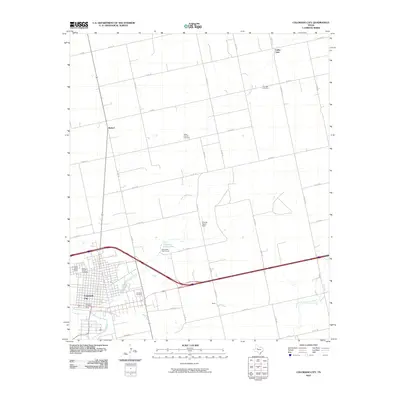
2010 Map of Colorado City
USGS Topo · Published 2010About this map
Colorado City sits as the central hub of this West Texas landscape, where the waters of Lone Wolf Creek wind through the city toward the Colorado River. The area’s spiritual and genealogical history is well-preserved through several burial grounds, including the Zion Rest Cemetery in the northeast and the Cemetery of the Sands to the west. Small community clusters like Valley View and Buford are connected by a web of rural farm-to-market roads and county routes that define the region's agricultural layout.
Find a feature on this map
50 named features on this map. Tap any name to fly to it.
Don’t see what you’re looking for? This feature index may not catch every label — zoom into the map to look around manually.
Map Details
Editions of this 2010 Colorado City Map
This is the sole edition of this map. No revisions or reprints were ever made.
Other maps of this area

1950 · Cedar Bend
USGS Topo · 1:24,000

1950 · Lake Colorado City
USGS Topo · 1:24,000

1950 · Colorado City SE
USGS Topo · 1:24,000

1951 · Dunn
USGS Topo · 1:24,000

1952 · China Grove
USGS Topo · 1:24,000

1952 · Colorado City
USGS Topo · 1:24,000

1954 · Big Spring
USGS Topo · 1:250,000

1958 · Big Spring
USGS Topo · 1:250,000

1969 · Baumann School
USGS Topo · 1:24,000

1969 · Loraine
USGS Topo · 1:24,000