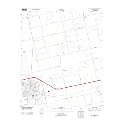
2012 Map of Colorado City
USGS Topo · Published 2012About this map
Colorado City serves as the focal point of this West Texas landscape, positioned where the Colorado River meets the tributary waters of Lone Wolf Cr. The town's grid is dense with street-level detail, bordered by significant local sites including the Mitchell County Cem and the uniquely named Cem of the Sands. The surrounding rural terrain reveals a network of ranching roads and small settlements like Buford and Valley View, reflecting the region's sparse but persistent agricultural footprint. To the north and east, the map traces the winding paths of several creeks and identifies isolated landmarks such as White Church Cem and Zion Rest Cem, which offer specific points of interest for genealogical research. The presence of Trulock Ranch Field Airport and the Wolf Creek Golf Course near Country Club Lake indicates how modern recreation and transport have integrated into this traditional ranching environment.
Find a feature on this map
89 named features on this map. Tap any name to fly to it.
Don’t see what you’re looking for? This feature index may not catch every label — zoom into the map to look around manually.
Map Details
Editions of this 2012 Colorado City Map
This is the sole edition of this map. No revisions or reprints were ever made.
Other maps of this area

1950 · Cedar Bend
USGS Topo · 1:24,000

1950 · Lake Colorado City
USGS Topo · 1:24,000

1950 · Colorado City SE
USGS Topo · 1:24,000

1951 · Dunn
USGS Topo · 1:24,000

1952 · China Grove
USGS Topo · 1:24,000

1952 · Colorado City
USGS Topo · 1:24,000

1954 · Big Spring
USGS Topo · 1:250,000

1958 · Big Spring
USGS Topo · 1:250,000

1969 · Baumann School
USGS Topo · 1:24,000

1969 · Loraine
USGS Topo · 1:24,000