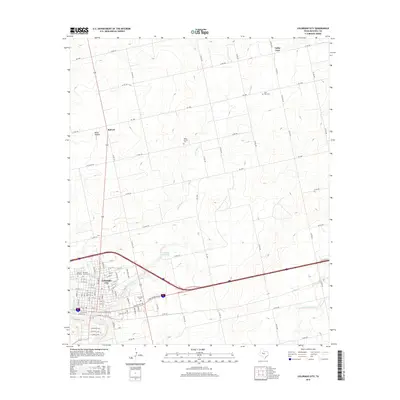
2016 Map of Colorado City
USGS Topo · Published 2016About this map
Colorado City serves as the regional hub in this 2016 survey, situated where the Colorado River meets the drainages of Lone Wolf Cr. The map documents the city's established grid and several significant burial sites that offer value for genealogical research, including the Mitchell County Cem, Colorado Cem, and the uniquely named Cem of the Sands. Beyond the city limits, the landscape transitions into a network of county roads and smaller community markers like White Church and its associated White Church Cem. To the north, the small settlements of Buford and Valley View anchor the rural terrain near Bone Hollow. The presence of Country Club Lake and the N Fork Champion Cr highlight the vital role of water management and recreation in this West Texas environment, while Interstate 20 bisects the area as the primary modern transit corridor.
Find a feature on this map
107 named features on this map. Tap any name to fly to it.
Don’t see what you’re looking for? This feature index may not catch every label — zoom into the map to look around manually.
Map Details
Editions of this 2016 Colorado City Map
This is the sole edition of this map. No revisions or reprints were ever made.
Other maps of this area

1950 · Cedar Bend
USGS Topo · 1:24,000

1950 · Lake Colorado City
USGS Topo · 1:24,000

1950 · Colorado City SE
USGS Topo · 1:24,000

1951 · Dunn
USGS Topo · 1:24,000

1952 · China Grove
USGS Topo · 1:24,000

1952 · Colorado City
USGS Topo · 1:24,000

1954 · Big Spring
USGS Topo · 1:250,000

1958 · Big Spring
USGS Topo · 1:250,000

1969 · Baumann School
USGS Topo · 1:24,000

1969 · Loraine
USGS Topo · 1:24,000