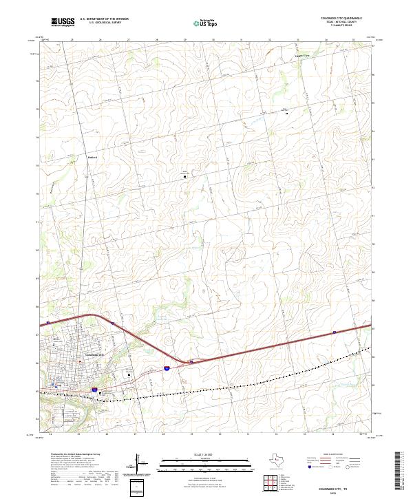
2022 Map of Colorado City
USGS Topo · Published 2022About this map
The Colorado River winds through the heart of this West Texas landscape, framing the seat of Mitchell County in a contemporary study of its layout and rural surroundings. Colorado City serves as the primary hub, where the Mitchell County Courthouse stands as a central landmark amidst a grid of streets that includes the Colorado City Cem and the Cumberland Presbyterian Cem. To the north, the terrain transitions into ranch and farmland, marked by smaller settlements like Buford and Valley View. The map highlights several local burial sites that provide significant genealogical value, including Zions Rest Cem and White Church Cem. Water features such as Lone Wolf Cr and Country Club Lake intersect the network of county roads and farm-to-market routes like FM 1982, illustrating the relationship between the regional hydrology and the transportation corridors that support this agricultural and civic center.
Find a feature on this map
108 named features on this map. Tap any name to fly to it.
Don’t see what you’re looking for? This feature index may not catch every label — zoom into the map to look around manually.
Map Details
Editions of this 2022 Colorado City Map
This is the sole edition of this map. No revisions or reprints were ever made.
Other maps of this area

1950 · Cedar Bend
USGS Topo · 1:24,000

1950 · Lake Colorado City
USGS Topo · 1:24,000

1950 · Colorado City SE
USGS Topo · 1:24,000

1951 · Dunn
USGS Topo · 1:24,000

1952 · China Grove
USGS Topo · 1:24,000

1952 · Colorado City
USGS Topo · 1:24,000

1954 · Big Spring
USGS Topo · 1:250,000

1958 · Big Spring
USGS Topo · 1:250,000

1969 · Baumann School
USGS Topo · 1:24,000

1969 · Loraine
USGS Topo · 1:24,000