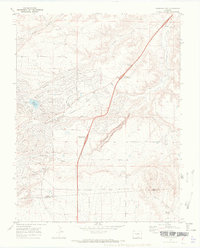
1969 Map of Colorado City
USGS Topo · Published 1972About this map
Colorado City appears in its early development stages on the cusp of the 1970s, showcasing an organized grid of residential streets such as Cuerno Verde Blvd and Jefferson Blvd set against the natural topography of the high plains. The landscape is defined by the sharp incision of the Graneros Gorge and a network of seasonal watercourses including Greenhorn Creek and Scroggs Arroyo. Local recreation and utility infrastructure are prominent, with the Beckwith Reservoir serving as a central focal point near the Golf Course and the Rodeo Ground. The map also captures the path of the interstate as it crosses the Pueblo Co Huerfano Co line. Significant industrial and ranching landmarks like the northern Gravel Pit and southern Watters Spring provide insight into the land use and resources that shaped this planned community's early years.
Find a feature on this map
44 named features on this map. Tap any name to fly to it.
Don’t see what you’re looking for? This feature index may not catch every label — zoom into the map to look around manually.
Map Details
Editions of this 1969 Colorado City Map
3 editions found
Other maps of this area

1891 · Walsenburg
USGS Topo · 1:125,000

1891 · Pueblo
USGS Topo · 1:125,000

1894 · Walsenburg
USGS Topo · 1:125,000

1894 · Pueblo
USGS Topo · 1:125,000

1896 · Pueblo
USGS Topo · 1:125,000

1897 · Pueblo
USGS Topo · 1:125,000

1897 · Walsenburg
USGS Topo · 1:125,000

1900 · Walsenburg
USGS Topo · 1:125,000

1954 · Trinidad
USGS Topo · 1:250,000

1954 · Pueblo
USGS Topo · 1:250,000