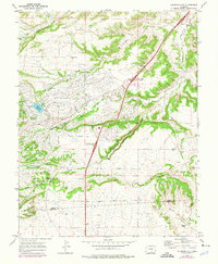
1969 Map of Colorado City
USGS Topo · Published 1976About this map
Colorado City is depicted here during a transformative period of planned development in Southern Colorado. The street grid reflects an ambitious master-planned community, with residential boulevards like Cuerno Verde Blvd and Brothers Blvd radiating outward from central recreation hubs. The landscape is anchored by Beckwith Reservoir and Greenhorn Meadows Park, which serve as the community's core along the banks of Greenhorn Creek.
Find a feature on this map
39 named features on this map. Tap any name to fly to it.
Don’t see what you’re looking for? This feature index may not catch every label — zoom into the map to look around manually.
Map Details
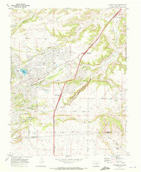
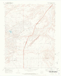
Editions of this 1969 Colorado City Map
3 editions found
Other maps of this area

1891 · Walsenburg
USGS Topo · 1:125,000

1891 · Pueblo
USGS Topo · 1:125,000

1894 · Walsenburg
USGS Topo · 1:125,000

1894 · Pueblo
USGS Topo · 1:125,000

1896 · Pueblo
USGS Topo · 1:125,000

1897 · Pueblo
USGS Topo · 1:125,000

1897 · Walsenburg
USGS Topo · 1:125,000

1900 · Walsenburg
USGS Topo · 1:125,000

1954 · Trinidad
USGS Topo · 1:250,000

1954 · Pueblo
USGS Topo · 1:250,000