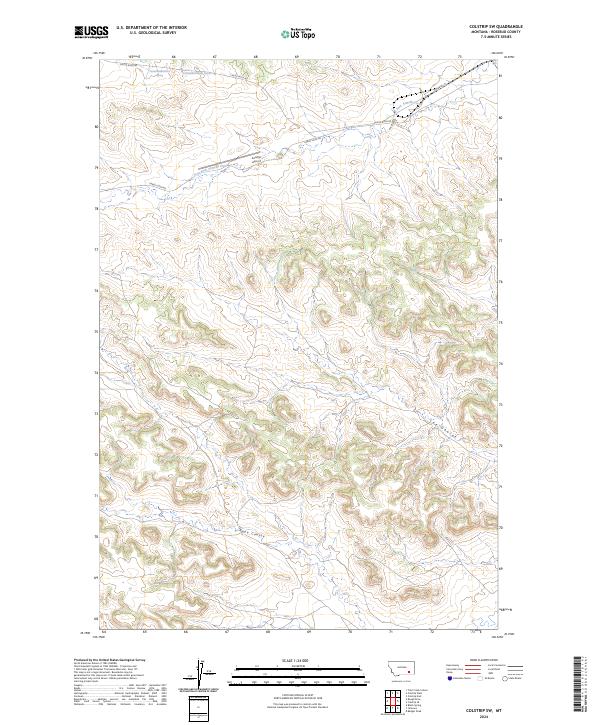
2024 Map of Colstrip SW
USGS Topo · Published 2024About this map
East Fork Armells Creek meanders through the northern section of this Rosebud County landscape, providing a primary drainage feature for the surrounding terrain. This modern survey reflects the rural character of the region, where infrastructure is centered around the Colstrip Airport and a network of secondary roads such as Castle Rock Rd and Farley Loop Rd. The topography is defined by significant coulees, including Rape Coulee and Lee Coulee, which illustrate the natural erosion patterns across the township and range boundaries. Specific water sources are identified by technical designations, including 01N40E02BBDD01 Spring and 01N40E02BDAB01 Spring, pinpointing critical resource locations in this arid Montana environment. The map provides clear documentation of land divisions, marking the junctions of T1N and T1S across ranges R40E and R41E.
Find a feature on this map
13 named features on this map. Tap any name to fly to it.
Don’t see what you’re looking for? This feature index may not catch every label — zoom into the map to look around manually.
Map Details
Editions of this 2024 Colstrip SW Map
This is the sole edition of this map. No revisions or reprints were ever made.
Other maps of this area

1954 · Hardin
USGS Topo · 1:250,000

1957 · Hardin
USGS Topo · 1:250,000

1958 · Hardin
USGS Topo · 1:250,000

1958 · Jimtown
USGS Topo · 1:24,000

1958 · Black Spring
USGS Topo · 1:24,000

1958 · Badger Peak
USGS Topo · 1:24,000

1971 · Trail Creek School
USGS Topo · 1:24,000

1971 · Colstrip SW
USGS Topo · 1:24,000

1971 · Colstrip SE
USGS Topo · 1:24,000

1971 · Rough Draw
USGS Topo · 1:24,000