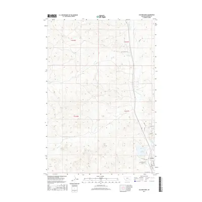
2017 Map of Colstrip West
USGS Topo · Published 2017About this map
Colstrip serves as the focal point of this western Rosebud County landscape, appearing here as it was established in the late 2010s. The settlement pattern is defined by modern residential streets such as Woodrose St and Cherry St, alongside the newer residential layout of Snider Subdivision Rd to the north. A significant portion of the area's geography is shaped by the drainage systems of McGilvrey Cr, E Fork Armells Cr, and Stocker Cr, which carve through the terrain. To the south, Castle Rock Lake is a prominent water feature, bordered by Castle Rock Lake Dr. This 2017 survey by the U.S. Geological Survey captures the town's expansion and its relationship with the surrounding plains and creeks, documenting the specific road networks like Pinebutte Dr and Stillwater Rd that connect this mining-influenced community to the broader Montana territory.
Find a feature on this map
24 named features on this map. Tap any name to fly to it.
Don’t see what you’re looking for? This feature index may not catch every label — zoom into the map to look around manually.
Map Details
Editions of this 2017 Colstrip West Map
This is the sole edition of this map. No revisions or reprints were ever made.
Other maps of this area

1954 · Hardin
USGS Topo · 1:250,000

1954 · Forsyth
USGS Topo · 1:250,000

1957 · Hardin
USGS Topo · 1:250,000

1957 · Forsyth
USGS Topo · 1:250,000

1958 · Forsyth
USGS Topo · 1:250,000

1958 · Hardin
USGS Topo · 1:250,000

1971 · Trail Creek School
USGS Topo · 1:24,000

1971 · Colstrip SW
USGS Topo · 1:24,000

1971 · Colstrip SE
USGS Topo · 1:24,000

1971 · Rough Draw
USGS Topo · 1:24,000