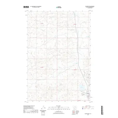
2020 Map of Colstrip West
USGS Topo · Published 2020About this map
Colstrip serves as the primary hub in this Rosebud County landscape, showing the residential expansion and street layout as it appeared in recent years. The map tracks the development of specialized housing areas such as the Snider Subdivision Rd, alongside numerous local roads including Pinebutte Dr and Stillwater Rd. The topography is defined by the complex drainage system of E Fork Armells Cr and its tributaries, including McGilvrey Cr, Corral Cr, and Stocker Cr. A significant hydrological feature is Castle Rock Lake, which sits at the heart of local recreation and water management. Researchers will also find specifically identified water sources like the 03N41E34CDD01 Spring, providing a detailed look at the rural and municipal water network in this part of Montana.
Find a feature on this map
28 named features on this map. Tap any name to fly to it.
Don’t see what you’re looking for? This feature index may not catch every label — zoom into the map to look around manually.
Map Details
Editions of this 2020 Colstrip West Map
This is the sole edition of this map. No revisions or reprints were ever made.
Other maps of this area

1954 · Hardin
USGS Topo · 1:250,000

1954 · Forsyth
USGS Topo · 1:250,000

1957 · Hardin
USGS Topo · 1:250,000

1957 · Forsyth
USGS Topo · 1:250,000

1958 · Forsyth
USGS Topo · 1:250,000

1958 · Hardin
USGS Topo · 1:250,000

1971 · Trail Creek School
USGS Topo · 1:24,000

1971 · Colstrip SW
USGS Topo · 1:24,000

1971 · Colstrip SE
USGS Topo · 1:24,000

1971 · Rough Draw
USGS Topo · 1:24,000