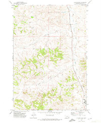
1971 Map of Colstrip West
USGS Topo · Published 1974About this map
East Fork Armells Creek winds through this Rosebud County landscape, following the corridor of the Burlington Northern railroad. The map depicts a transition in land use during the early 1970s, as the industrial and infrastructure needs of the area centered around Colstrip began to shape the terrain. Numerous Well and Drill Hole markers are scattered across the quadrangle, particularly along the drainage basins of McGilvrey Creek, Corral Creek, and Stocker Creek. Near the southern edge of the sheet, the presence of a Golf Course and a large Reservoir adjacent to the town site indicates the early development of community amenities alongside the expanding local industry. The map meticulously records the elevation changes of the surrounding hills, noted by detailed contouring between the creek forks and rail lines.
Find a feature on this map
13 named features on this map. Tap any name to fly to it.
Don’t see what you’re looking for? This feature index may not catch every label — zoom into the map to look around manually.
Map Details
Editions of this 1971 Colstrip West Map
This is the sole edition of this map. No revisions or reprints were ever made.
Other maps of this area

1954 · Hardin
USGS Topo · 1:250,000

1954 · Forsyth
USGS Topo · 1:250,000

1957 · Hardin
USGS Topo · 1:250,000

1957 · Forsyth
USGS Topo · 1:250,000

1958 · Forsyth
USGS Topo · 1:250,000

1958 · Hardin
USGS Topo · 1:250,000

1971 · Trail Creek School
USGS Topo · 1:24,000

1971 · Colstrip SW
USGS Topo · 1:24,000

1971 · Colstrip SE
USGS Topo · 1:24,000

1971 · Rough Draw
USGS Topo · 1:24,000