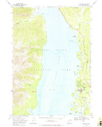
1968 Map of Colter Bay
USGS Topo · Published 1974About this map
Grand Teton National Park dominates this late-1960s landscape, centered on the deep blue waters of Jackson Lake. The eastern shore serves as the primary hub for park infrastructure, notably at Colter Bay Village, which includes a Visitor Center, Amphitheater, and extensive Campground facilities. This developed area is contrasted by the rugged wilderness of the Teton Range to the west, where steep drainages like Colter Canyon, Webb Canyon, and Waterfalls Canyon plunge toward the shoreline. High-altitude landmarks such as Columbine Cascade and Wilcox Point define the western ridges, while the southern peninsula near Hermitage Point contains quieter water bodies like Swan Lake and Heron Pond. The map reveals the intricate shoreline of the lake, punctuated by numerous islands such as Indian Island and Moose Island, illustrating the complex glacial geography of this high-elevation mountain basin.
Find a feature on this map
36 named features on this map. Tap any name to fly to it.
Don’t see what you’re looking for? This feature index may not catch every label — zoom into the map to look around manually.
Map Details
Editions of this 1968 Colter Bay Map
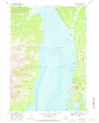
2 editions found
Other maps of this area

1886 · Shoshone
USGS Topo · 1:125,000

1888 · Shoshone
USGS Topo · 1:125,000

1895 · Shoshone
USGS Topo · 1:125,000

1899 · Grand Teton
USGS Topo · 1:125,000

1901 · Shoshone
USGS Topo · 1:125,000

1901 · Grand Teton
USGS Topo · 1:125,000

1908 · Shoshone
USGS Topo · 1:125,000

1911 · Shoshone
USGS Topo · 1:125,000

1955 · Ashton
USGS Topo · 1:250,000

1955 · Driggs
USGS Topo · 1:250,000