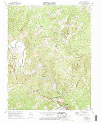
1970 Map of Columbia
USGS Topo · Published 1984About this map
The Rivanna River carves a winding path through the heart of Fluvanna County, defining the landscape at landmarks like Hells Bend and Buzzard Rock. This 1970 snapshot, based on late 1950s and 1960s aerial surveys, captures the region's rural character and transportation network just before major modern development. The town of Columbia sits at the confluence near Point of Fork, where the Chesapeake and Ohio railroad tracks follow the river's curve.
Find a feature on this map
43 named features on this map. Tap any name to fly to it.
Don’t see what you’re looking for? This feature index may not catch every label — zoom into the map to look around manually.
Map Details
Editions of this 1970 Columbia Map
3 editions found
Other maps of this area

1891 · Palmyra
USGS Topo · 1:125,000

1895 · Palmyra
USGS Topo · 1:125,000

1897 · Palmyra
USGS Topo · 1:125,000

1943 · Scottsville
USGS Topo · 1:62,500

1946 · Scottsville
USGS Topo · 1:62,500

1947 · Roanoke
USGS Topo · 1:250,000

1950 · Dillwyn
USGS Topo · 1:62,500

1958 · Dillwyn
USGS Topo · 1:62,500

1959 · Roanoke
USGS Topo · 1:250,000

1960 · Columbia
USGS Topo · 1:62,500