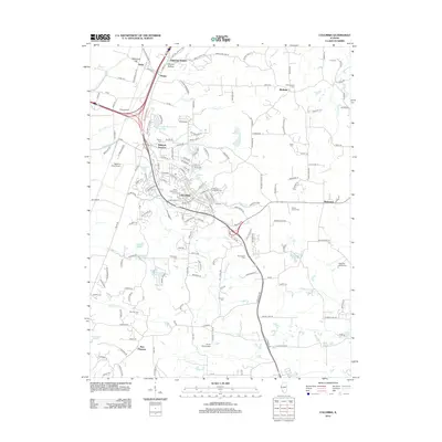
2012 Map of Columbia
USGS Topo · Published 2012About this map
Columbia serves as the central hub of this Monroe County landscape, where the flatlands near the Mississippi River transition into the rising terrain of Sugar Loaf Hill. The area shows a sophisticated network of transportation and community landmarks, from the aviation sites of King Airport and Sackman Field Airport to the cluster of historical burial grounds that trace family lineages, such as Lark Cem and Kleinschmidt Cem. Smaller settlements like Millstadt Junction, Bixby, and New Hanover dot the map, connected by a dense web of local roads like Davis Street Ferry Rd.
Find a feature on this map
179 named features on this map. Tap any name to fly to it.
Don’t see what you’re looking for? This feature index may not catch every label — zoom into the map to look around manually.
Map Details
Editions of this 2012 Columbia Map
This is the sole edition of this map. No revisions or reprints were ever made.
Other maps of this area

1888 · St. Louis
USGS Topo · 1:62,500

1910 · Waterloo
USGS Topo · 1:62,500

1912 · Kimmswick
USGS Topo · 1:62,500

1913 · Waterloo
USGS Topo · 1:62,500

1916 · Kimmswick
USGS Topo · 1:62,500

1931 · French Village
USGS Topo · 1:24,000

1933 · Jefferson Barracks
USGS Topo · 1:24,000

1933 · Cahokia
USGS Topo · 1:24,000

1934 · Cahokia
USGS Topo · 1:24,000

1935 · French Village
USGS Topo · 1:24,000