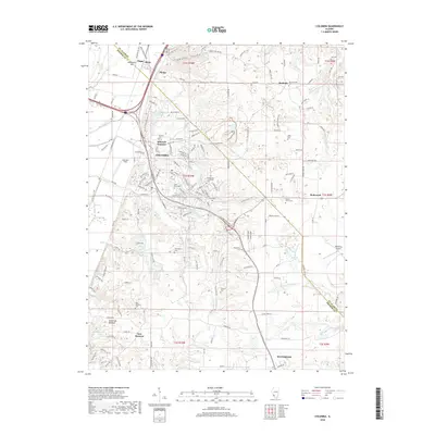
2018 Map of Columbia
USGS Topo · Published 2018About this map
Columbia serves as the focal point of this region south of East St. Louis, where the upland bluffs transition into the fertile American Bottoms. The landscape is a complex network of family-named roads and drainage features like Hill Lake Cr and Wilson Cr. Of particular interest to genealogists is the high density of small family or church burial grounds, including Lark Cem, Kleinschmidt Cem, and Baltz Cem, scattered among the rural townships. Industrial activity is represented by the Columbia Quarry Rd and the Illinois Central Gulf railroad, which cuts a diagonal path through the terrain. The map also documents aviation sites like Sackman Field and the Riebeling Airport on the eastern edge, alongside small settlements such as Millstadt Junction and Bluffside.
Find a feature on this map
163 named features on this map. Tap any name to fly to it.
Don’t see what you’re looking for? This feature index may not catch every label — zoom into the map to look around manually.
Map Details
Editions of this 2018 Columbia Map
This is the sole edition of this map. No revisions or reprints were ever made.
Other maps of this area

1888 · St. Louis
USGS Topo · 1:62,500

1910 · Waterloo
USGS Topo · 1:62,500

1912 · Kimmswick
USGS Topo · 1:62,500

1913 · Waterloo
USGS Topo · 1:62,500

1916 · Kimmswick
USGS Topo · 1:62,500

1931 · French Village
USGS Topo · 1:24,000

1933 · Jefferson Barracks
USGS Topo · 1:24,000

1933 · Cahokia
USGS Topo · 1:24,000

1934 · Cahokia
USGS Topo · 1:24,000

1935 · French Village
USGS Topo · 1:24,000