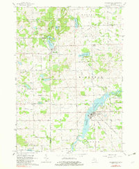
1963 Map of Columbiaville
USGS Topo · Published 1982About this map
Columbiaville and Otter Lake anchor this Michigan landscape where the Lapeer, Genesee, and Tuscola county lines converge. The southern reach of the map is dominated by the Holloway Reservoir, an expansive impoundment of the Flint River that fundamentally altered the local drainage and topography. Surrounding these waters are protected lands including the Murphy Lake State Game Area and Lapeer State Game Area, reflecting a mid-century shift toward conservation and public recreation.
Find a feature on this map
82 named features on this map. Tap any name to fly to it.
Don’t see what you’re looking for? This feature index may not catch every label — zoom into the map to look around manually.
Map Details
Editions of this 1963 Columbiaville Map
2 editions found
Other maps of this area

1920 · Flint
USGS Topo · 1:62,500

1922 · Flint
USGS Topo · 1:62,500

1943 · Flint
USGS Topo · 1:62,500

1954 · Flint
USGS Topo · 1:250,000

1958 · Flint
USGS Topo · 1:250,000

1963 · Mayville
USGS Topo · 1:24,000

1963 · Columbiaville
USGS Topo · 1:24,000

1963 · Elba
USGS Topo · 1:24,000

1963 · Vassar
USGS Topo · 1:24,000

1963 · Juniata
USGS Topo · 1:24,000