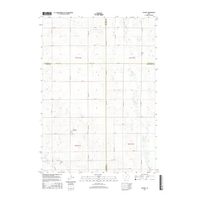
2015 Map of Colwell
USGS Topo · Published 2015About this map
Colwell serves as the primary community hub in this region of northern Iowa, situated amidst a precise grid of sections and rural roads. The landscape is defined by the winding course of the Little Cedar River in the southwest and the subtle drainage of Beaver Cr, which meanders through the central acreage. This 2015 survey illustrates the enduring agricultural character of the territory, where the intersection of Co Hwy T72 and local routes like 140th St anchor the local geography. Genealogy researchers will find significant landmarks in the outlying areas, including Saint Patricks Cem to the northeast and Beckwith Cem near the southern boundary. The map clearly delineates the convergence of four counties—Mitchell, Howard, Floyd, and Chickasaw—marking a unique jurisdictional corner that has shaped local land records and property lines for generations.
Find a feature on this map
40 named features on this map. Tap any name to fly to it.
Don’t see what you’re looking for? This feature index may not catch every label — zoom into the map to look around manually.
Map Details
Editions of this 2015 Colwell Map
This is the sole edition of this map. No revisions or reprints were ever made.
Other maps of this area

1954 · Mason City
USGS Topo · 1:250,000

1957 · Mason City
USGS Topo · 1:250,000

1958 · Mason City
USGS Topo · 1:250,000

1971 · Charles City
USGS Topo · 1:24,000

1971 · Bassett
USGS Topo · 1:24,000

1971 · Colwell
USGS Topo · 1:24,000

1971 · Floyd
USGS Topo · 1:24,000

1972 · New Haven
USGS Topo · 1:24,000

1972 · Riceville
USGS Topo · 1:24,000
1972 · Ionia
USGS Topo · 1:24,000