
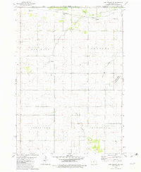
1972 Map of Riceville
USGS Topo · Published 1974About this map
Riceville sits at the intersection of agricultural industry and regional transit, straddling the Mitchell Co Howard Co line in northern Iowa. During the early 1970s, the community’s layout is defined by the Chicago and North Western railroad corridor and its proximity to the Wapsipinicon River. The surrounding landscape is divided into the townships of Jenkins, Jamestown, Douglas, and Afton, reflecting a well-established rural survey grid. Notable local landmarks include Lake Hendricks with its associated picnic area and the small Mosher Airport to the northwest. For those researching family history, several burial grounds are scattered across the quadrangle, including Township Cem, Calvary Cem, St Peters Cem, and the more southern Reckner Cem. The presence of Dishinger and numerous gravel pits highlights the local infrastructure and smaller settlements that supported the farming economy of the era.
Find a feature on this map
23 named features on this map. Tap any name to fly to it.
Don’t see what you’re looking for? This feature index may not catch every label — zoom into the map to look around manually.
Map Details
Editions of this 1972 Riceville Map
This is the sole edition of this map. No revisions or reprints were ever made.
Other maps of this area

1954 · Mason City
USGS Topo · 1:250,000

1957 · Mason City
USGS Topo · 1:250,000

1958 · Mason City
USGS Topo · 1:250,000

1971 · Colwell
USGS Topo · 1:24,000

1971 · Floyd
USGS Topo · 1:24,000

1972 · Mc Intire
USGS Topo · 1:24,000

1972 · Little Cedar
USGS Topo · 1:24,000

1972 · New Haven
USGS Topo · 1:24,000

1972 · Elma
USGS Topo · 1:24,000
1981 · Lime Springs NW
USGS Topo · 1:24,000