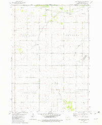
1981 Map of Lime Springs NW
USGS Topo · Published 1982About this map
The Upper Iowa River winds through the northern reaches of Howard County in the early 1980s, carving a valley that defines the local topography. This agricultural landscape is organized into civil townships including Oak Dale, Chester, Jamestown, and Saratoga, where the section lines of the Public Land Survey System dictate the placement of farmsteads and rural roads. The northern border marks the transition into Minnesota at the Mower County and Fillmore County lines.
Find a feature on this map
17 named features on this map. Tap any name to fly to it.
Don’t see what you’re looking for? This feature index may not catch every label — zoom into the map to look around manually.
Map Details
Editions of this 1981 Lime Springs NW Map
This is the sole edition of this map. No revisions or reprints were ever made.
Other maps of this area

1954 · Mason City
USGS Topo · 1:250,000

1957 · Mason City
USGS Topo · 1:250,000

1958 · Mason City
USGS Topo · 1:250,000

1965 · Le Roy
USGS Topo · 1:24,000

1965 · Ostrander
USGS Topo · 1:24,000

1965 · Cherry Grove
USGS Topo · 1:24,000

1972 · Mc Intire
USGS Topo · 1:24,000

1972 · Riceville
USGS Topo · 1:24,000

1981 · Lourdes
USGS Topo · 1:24,000

1981 · Lime Springs
USGS Topo · 1:24,000