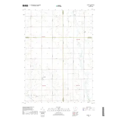
2018 Map of Colwell
USGS Topo · Published 2018About this map
Colwell serves as the primary hub in this Iowa landscape, situated at the intersection of Co Hwy T72 and 140th Street. The terrain is defined by the winding paths of the Wapsipinicon River to the east and the Little Cedar River to the southwest, with Beaver Cr cutting through the center of the township. This modern survey reflects the enduring section-line grid system, where long-established road names like Addison Ave and Victory Ave segment the agricultural fields. Genealogists can identify significant burial sites in the region, including Saint Patricks Cem in the northeast corner and Beckwith Cem located just off Co Hwy B33. The map captures the meeting of four counties—Mitchell, Howard, Floyd, and Chickasaw—marking a vital corner of the state's rural geography.
Find a feature on this map
43 named features on this map. Tap any name to fly to it.
Don’t see what you’re looking for? This feature index may not catch every label — zoom into the map to look around manually.
Map Details
Editions of this 2018 Colwell Map
This is the sole edition of this map. No revisions or reprints were ever made.
Other maps of this area

1954 · Mason City
USGS Topo · 1:250,000

1957 · Mason City
USGS Topo · 1:250,000

1958 · Mason City
USGS Topo · 1:250,000

1971 · Charles City
USGS Topo · 1:24,000

1971 · Bassett
USGS Topo · 1:24,000

1971 · Colwell
USGS Topo · 1:24,000

1971 · Floyd
USGS Topo · 1:24,000

1972 · New Haven
USGS Topo · 1:24,000

1972 · Riceville
USGS Topo · 1:24,000
1972 · Ionia
USGS Topo · 1:24,000