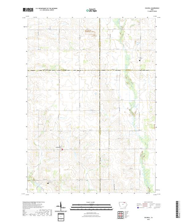
2022 Map of Colwell
USGS Topo · Published 2022About this map
Colwell serves as the central hub of this agricultural landscape at the intersection of Co Hwy T72 and 140th St. This survey captures a specific corner of North-Central Iowa where four counties—Floyd, Mitchell, Howard, and Chickasaw—converge. The terrain is defined by the drainage patterns of the Wapsipinicon River in the east and the Little Cedar River in the southwest, with Beaver Cr winding through the center of the township. Local genealogy is anchored by historic burial sites like Saint Patricks Cem near the Howard and Chickasaw line, and Beckwith Cem located south of the main settlement. The strictly rectilinear road grid, composed of routes such as Victory Ave and Windfall Ave, reflects the enduring legacy of the Public Land Survey System in organizing the region's productive farmland.
Find a feature on this map
43 named features on this map. Tap any name to fly to it.
Don’t see what you’re looking for? This feature index may not catch every label — zoom into the map to look around manually.
Map Details
Editions of this 2022 Colwell Map
This is the sole edition of this map. No revisions or reprints were ever made.
Other maps of this area

1954 · Mason City
USGS Topo · 1:250,000

1957 · Mason City
USGS Topo · 1:250,000

1958 · Mason City
USGS Topo · 1:250,000

1971 · Charles City
USGS Topo · 1:24,000

1971 · Bassett
USGS Topo · 1:24,000

1971 · Colwell
USGS Topo · 1:24,000

1971 · Floyd
USGS Topo · 1:24,000

1972 · New Haven
USGS Topo · 1:24,000

1972 · Riceville
USGS Topo · 1:24,000
1972 · Ionia
USGS Topo · 1:24,000