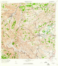
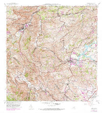
1957 Map of Comerio
USGS Topo · Published 1960About this map
The Río de la Plata carves a deep, winding course through the central highlands of Puerto Rico, anchoring a landscape where agricultural traditions met mid-century modernization. In the late 1950s, the urban centers of Comerio and Cidra served as essential hubs for the surrounding barrios. The presence of the Escuela Vocacional Eugenio María de Hostos and the Escuela Superior de Comerío points to a period of significant educational investment in the mountain communities.
Find a feature on this map
95 named features on this map. Tap any name to fly to it.
Don’t see what you’re looking for? This feature index may not catch every label — zoom into the map to look around manually.
Map Details
Editions of this 1957 Comerio Map
5 editions found
Other maps of this area

1946 · Patillas
USGS Topo · 1:30,000

1946 · Coamo
USGS Topo · 1:30,000

1946 · Aguas Buenas
USGS Topo · 1:30,000

1946 · Corozal
USGS Topo · 1:30,000

1946 · Barranquitas
USGS Topo · 1:30,000

1946 · Cayey
USGS Topo · 1:30,000

1946 · Comerio
USGS Topo · 1:30,000

1946 · Naranjito
USGS Topo · 1:30,000

1946 · Caguas
USGS Topo · 1:30,000

1947 · Cayey NO
USGS Topo · 1:10,000