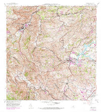
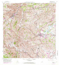
1957 Map of Comerio
USGS Topo · Published 1982About this map
Comerio sits at the heart of this mid-century landscape, positioned along the winding Rio de la Plata. The terrain is defined by dramatic elevation changes, notably at Cerro La Tiza and Cerro Santa Bárbara, where the drainage network of Quebrada Dona Elena and Quebrada Cedrito carves through the mountains. To the southeast, the development of Cidra centers around the expansive Lago Cidra, providing a contrast to the dense mountainous barrios like Palomas and Honduras.
Find a feature on this map
91 named features on this map. Tap any name to fly to it.
Don’t see what you’re looking for? This feature index may not catch every label — zoom into the map to look around manually.
Map Details
Editions of this 1957 Comerio Map
5 editions found
Other maps of this area

1946 · Patillas
USGS Topo · 1:30,000

1946 · Coamo
USGS Topo · 1:30,000

1946 · Aguas Buenas
USGS Topo · 1:30,000

1946 · Corozal
USGS Topo · 1:30,000

1946 · Barranquitas
USGS Topo · 1:30,000

1946 · Cayey
USGS Topo · 1:30,000

1946 · Comerio
USGS Topo · 1:30,000

1946 · Naranjito
USGS Topo · 1:30,000

1946 · Caguas
USGS Topo · 1:30,000

1947 · Cayey NO
USGS Topo · 1:10,000