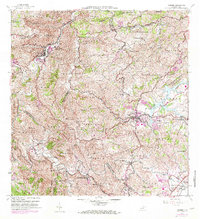
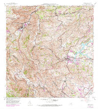
1957 Map of Comerio
USGS Topo · Published 1982About this map
Comerio and Cidra anchor this mid-century portrait of Puerto Rico's central highlands, where the dramatic topography is carved by the Rio de la Plata. The map illustrates a landscape in transition, where established barrios like Vega Redonda and Dona Elena are connected by a growing network of insular routes including PR 156 and PR 172. Educational infrastructure is particularly well-documented, featuring institutions such as the Escuela Superior de Comerio and the Escuela Vocacional Eugenio Maria de Hostos. To the southeast, the development around Lago Cidra and the settlement of Vegas near Central Cayey reflect the regional patterns of water management and local industry. The dense network of mountain peaks, including Cerro La Tiza and Cerro Maguayo, underscores the isolation and distinct character of the various sectors within the boundary of Comerio and Cidra.
Find a feature on this map
89 named features on this map. Tap any name to fly to it.
Don’t see what you’re looking for? This feature index may not catch every label — zoom into the map to look around manually.
Map Details
Editions of this 1957 Comerio Map
5 editions found
Other maps of this area

1946 · Patillas
USGS Topo · 1:30,000

1946 · Coamo
USGS Topo · 1:30,000

1946 · Aguas Buenas
USGS Topo · 1:30,000

1946 · Corozal
USGS Topo · 1:30,000

1946 · Barranquitas
USGS Topo · 1:30,000

1946 · Cayey
USGS Topo · 1:30,000

1946 · Comerio
USGS Topo · 1:30,000

1946 · Naranjito
USGS Topo · 1:30,000

1946 · Caguas
USGS Topo · 1:30,000

1947 · Cayey NO
USGS Topo · 1:10,000