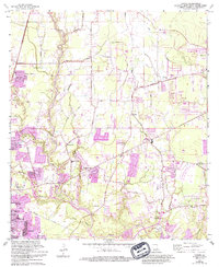
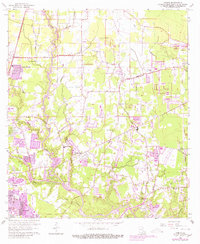
1962 Map of Comite
USGS Topo · Published 1994About this map
The Comite River meanders through this East Baton Rouge Parish landscape, defining the character of the settlements from Baker to Central. This region, documented across several decades of revisions, shows the transition of rural Louisiana into a suburban network. Community life is anchored by numerous local congregations and burial grounds, including the Shady Grove Ch and Evening Star Cem near Brown Heights, as well as the Friendship Ch situated along the winding Blackwater Bayou. The landscape's economic activity is evidenced by several sandpits and the presence of Glen Oaks High Sch in the burgeoning southern outskirts. Farther east, family-named sites like the Devall Cem and Odom Cem sit near Hub Beaver Bayou, offering clear markers for genealogical research in a territory defined by its complex bayou drainage systems and old parish roads.
Find a feature on this map
52 named features on this map. Tap any name to fly to it.
Don’t see what you’re looking for? This feature index may not catch every label — zoom into the map to look around manually.
Map Details
Editions of this 1962 Comite Map
5 editions found
Other maps of this area

1906 · Bayou Sara
USGS Topo · 1:125,000

1908 · Baton Rouge
USGS Topo · 1:62,500

1934 · Denham Springs
USGS Topo · 1:62,500

1939 · Zachary
USGS Topo · 1:62,500

1939 · Denham Springs
USGS Topo · 1:62,500

1939 · Baton Rouge
USGS Topo · 1:62,500

1942 · Pride
USGS Topo · 1:31,680

1942 · Watson
USGS Topo · 1:31,680

1953 · Baton Rouge West
USGS Topo · 1:24,000
1953 · Baton Rouge East
USGS Topo · 1:24,000