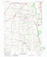
1966 Map of Commercial Point
USGS Topo · Published 1988About this map
Scioto River valley lands south of Columbus reveal a landscape transitioning between mid-century agriculture and growing suburban infrastructure. The 1966 data, updated with 1980s developments in purple, highlights the expansion of Grove City and the sprawling grounds of the Orient State Institute. Along the western bank of the river, small settlements like Shadeville and Commercial Point maintain their footing amidst a network of named country roads such as Rensch Road and Orders Road.
Find a feature on this map
55 named features on this map. Tap any name to fly to it.
Don’t see what you’re looking for? This feature index may not catch every label — zoom into the map to look around manually.
Map Details
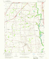
Editions of this 1966 Commercial Point Map
2 editions found
Other maps of this area

1911 · Era
USGS Topo · 1:62,500

1913 · Era
USGS Topo · 1:62,500

1914 · Circleville
USGS Topo · 1:62,500

1923 · West Columbus
USGS Topo · 1:62,500

1925 · East Columbus
USGS Topo · 1:62,500

1925 · West Columbus
USGS Topo · 1:62,500

1943 · Era
USGS Topo · 1:62,500

1943 · Circleville
USGS Topo · 1:62,500

1943 · East Columbus
USGS Topo · 1:62,500

1947 · Columbus
USGS Topo · 1:250,000