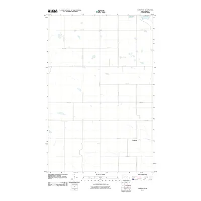
2011 Map of Comstock
USGS Topo · Published 2011About this map
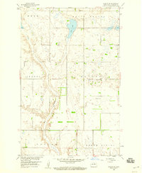
The settlement of Comstock anchors this North Dakota landscape, situated within a strictly organized grid of agricultural roads in Benson County. The terrain is defined by its glacial prairie potholes and drainage patterns, with Lake Ibsen appearing in the northeast corner of the quadrangle. This 2011 survey illustrates the modern rural infrastructure of the Red River Valley region, where section lines are strictly followed by routes such as 57th St NE and 53rd Ave NE. Local history is preserved at the Wilmerth Cemetery, a quiet landmark located central to the surrounding farmsteads. The map captures the intersection of natural hydrology and human geometry, showing how small seasonal water bodies are bypassed by the precise network of gravel and local roads like 51st St NE.
Find a feature on this map
17 named features on this map. Tap any name to fly to it.
Don’t see what you’re looking for? This feature index may not catch every label — zoom into the map to look around manually.
Map Details
Editions of this 2011 Comstock Map
This is the sole edition of this map. No revisions or reprints were ever made.
Other maps of this area

1953 · Devils Lake
USGS Topo · 1:250,000

1956 · Devils Lake
USGS Topo · 1:250,000

1956 · Brinsmade
USGS Topo · 1:24,000

1957 · Comstock
USGS Topo · 1:24,000
1957 · Brinsmade
USGS Topo · 1:24,000
1958 · Minnewaukan West
USGS Topo · 1:24,000
1958 · Brinsmade SW
USGS Topo · 1:24,000

1958 · Harlow
USGS Topo · 1:24,000
1958 · Harlow SE
USGS Topo · 1:24,000

1971 · York
USGS Topo · 1:24,000