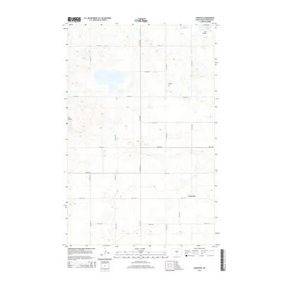
2014 Map of Comstock
USGS Topo · Published 2014About this map
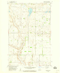
Lake Ibsen and the surrounding prairie of Benson County dominate this landscape, reflecting the classic township-and-range surveying of the American Great Plains. The small settlement of Comstock sits in the southeastern portion of the map, served by a network of sectional roads such as 51st St NE and 57th Ave NE. To the north, the land is marked by Big Coulee and several smaller unnamed basins typical of the region's glaciated topography. Genealogical interest centers on Wilmerth Cem, located near the center of the quadrangle. The western edge of the sheet features a distinct topographical rise known as The Buttes, providing a rare elevation break in the otherwise steady terrain. This survey illustrates the persistent agricultural grid and the sparse, centralized community hubs that characterize 21st-century rural North Dakota.
Find a feature on this map
18 named features on this map. Tap any name to fly to it.
Don’t see what you’re looking for? This feature index may not catch every label — zoom into the map to look around manually.
Map Details
Editions of this 2014 Comstock Map
This is the sole edition of this map. No revisions or reprints were ever made.
Other maps of this area

1953 · Devils Lake
USGS Topo · 1:250,000

1956 · Devils Lake
USGS Topo · 1:250,000

1956 · Brinsmade
USGS Topo · 1:24,000

1957 · Comstock
USGS Topo · 1:24,000
1957 · Brinsmade
USGS Topo · 1:24,000
1958 · Minnewaukan West
USGS Topo · 1:24,000
1958 · Brinsmade SW
USGS Topo · 1:24,000

1958 · Harlow
USGS Topo · 1:24,000
1958 · Harlow SE
USGS Topo · 1:24,000

1971 · York
USGS Topo · 1:24,000