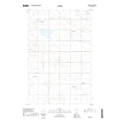
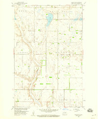
2017 Map of Comstock
USGS Topo · Published 2017About this map
Lake Ibsen and the surrounding prairie terrain of Benson County define this northern landscape, captured in the decade following the turn of the millennium. The area is characterized by scattered wetlands and significant hydrological features such as Big Coulee, which drains toward the northeast corner of the sheet. For genealogists and local historians, the Wilmerth Cem stands as a notable landmark in the northern reaches, situated near the intersection of several section-line roads like 57th St NE. The small community of Comstock is positioned in the southeast, serving as a focal point in a region primarily structured by the Public Land Survey System, as evidenced by the clearly marked boundaries of t155n r69w, t155n r68w, t154n r69w, and t154n r68w. Elevated relief is primarily found at The Buttes in the west, rising above the relatively level plains that have long supported agricultural life in North Dakota.
Find a feature on this map
15 named features on this map. Tap any name to fly to it.
Don’t see what you’re looking for? This feature index may not catch every label — zoom into the map to look around manually.
Map Details
Editions of this 2017 Comstock Map
This is the sole edition of this map. No revisions or reprints were ever made.
Other maps of this area

1953 · Devils Lake
USGS Topo · 1:250,000

1956 · Devils Lake
USGS Topo · 1:250,000

1956 · Brinsmade
USGS Topo · 1:24,000

1957 · Comstock
USGS Topo · 1:24,000
1957 · Brinsmade
USGS Topo · 1:24,000
1958 · Minnewaukan West
USGS Topo · 1:24,000
1958 · Brinsmade SW
USGS Topo · 1:24,000

1958 · Harlow
USGS Topo · 1:24,000
1958 · Harlow SE
USGS Topo · 1:24,000

1971 · York
USGS Topo · 1:24,000