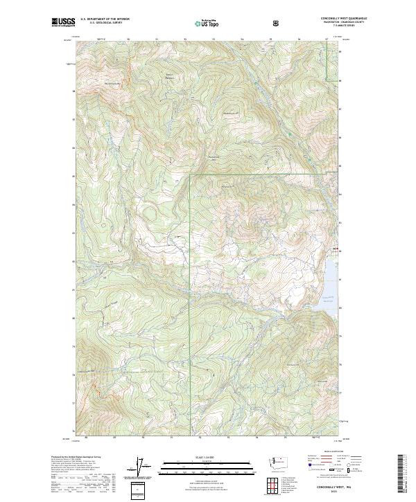
2023 Map of Conconully West
USGS Topo · Published 2023About this map
Okanogan National Forest dominates this high-elevation landscape, where complex drainage systems and steep ridgelines define the terrain west of the Conconully basin. The map reveals a network of watercourses including Buckhorn Creek, Ray Creek, and West Fork Salmon Creek that converge toward the Conconully Reservoir at the eastern edge. Prominent landmarks such as Muckamuck Mtn, Mineral Hill, and Peacock Mtn rise above the valleys, while localized features like Sophys Meadows and Salmon Falls indicate specific points of interest for those navigating the forest. Forest infrastructure is represented by routes such as Nat For Dev Rd 37 and the Tunnel Trl, which provide access to the backcountry. The presence of Muckamuck Pass and Reed Ridge further illustrates the high-relief geography that characterizes this portion of Okanogan County, reflecting the modern management and recreational layout of these protected public lands.
Find a feature on this map
46 named features on this map. Tap any name to fly to it.
Don’t see what you’re looking for? This feature index may not catch every label — zoom into the map to look around manually.
Map Details
Editions of this 2023 Conconully West Map
This is the sole edition of this map. No revisions or reprints were ever made.
Other maps of this area

1905 · Okanogan
USGS Topo · 1:125,000

1906 · Chopaka
USGS Topo · 1:125,000

1954 · Okanogan
USGS Topo · 1:250,000

1956 · Loup Loup
USGS Topo · 1:62,500

1956 · Tiffany Mountain
USGS Topo · 1:62,500

1957 · Okanogan
USGS Topo · 1:62,500

1957 · Conconully
USGS Topo · 1:62,500

1958 · Okanogan
USGS Topo · 1:250,000
1980 · Blue Goat Mtn
USGS Topo · 1:24,000
1980 · Ruby Hill
USGS Topo · 1:24,000