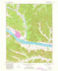
1967 Map of Concord
USGS Topo · Published 1982About this map
The Ohio River forms the central spine of this landscape, separating the rugged hollows of Adams Co, Ohio, from the riverfront settlements of Lewis Co, Kentucky. In the late 1960s, the river economy is clearly visible through the heavy infrastructure of the Chesapeake and Ohio railroad corridor, which parallels the southern bank. Small rail stops like Chalkley Station and Rome Station serve the valley, while the town of Concord anchors the western riverbend.
Find a feature on this map
53 named features on this map. Tap any name to fly to it.
Don’t see what you’re looking for? This feature index may not catch every label — zoom into the map to look around manually.
Map Details
Editions of this 1967 Concord Map
3 editions found
Other maps of this area

1916 · Peebles
USGS Topo · 1:62,500

1918 · Peebles
USGS Topo · 1:62,500

1918 · Seaman
USGS Topo · 1:62,500

1919 · Vanceburg
USGS Topo · 1:62,500

1929 · Springdale
USGS Topo · 1:48,000

1935 · Springdale
USGS Topo · 1:62,500

1949 · Vanceburg
USGS Topo · 1:62,500

1949 · Buena Vista
USGS Topo · 1:24,000

1949 · Vanceburg
USGS Topo · 1:24,000

1949 · Concord
USGS Topo · 1:24,000