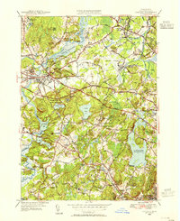
1950 Map of Concord
USGS Topo · Published 1955About this map
Concord serves as the focal point of this mid-century landscape, where the confluence of the Assabet River and the Sudbury River forms the Concord River. The map illustrates the town's literary and philosophical legacy, marking the Walden Pond State Reservation and Walden Pond itself, alongside Authors Ridge. This 1950 revision captures the region's transition from a rural intellectual enclave to a modernizing suburban corridor, evidenced by the development of the Bedford Airport and the expansive Cambridge Reservoir.
Find a feature on this map
79 named features on this map. Tap any name to fly to it.
Don’t see what you’re looking for? This feature index may not catch every label — zoom into the map to look around manually.
Map Details
Editions of this 1950 Concord Map
4 editions found
Other maps of this area

1886 · Lawrence
USGS Topo · 1:62,500

1886 · Lowell
USGS Topo · 1:62,500

1886 · Framingham
USGS Topo · 1:62,500

1888 · Lawrence
USGS Topo · 1:62,500

1889 · Framingham
USGS Topo · 1:62,500

1893 · Lowell
USGS Topo · 1:62,500

1893 · Boston
USGS Topo · 1:62,500

1893 · Lawrence
USGS Topo · 1:62,500

1894 · Framingham
USGS Topo · 1:62,500

1903 · Boston
USGS Topo · 1:62,500