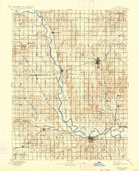
1892 Map of Concordia
USGS Topo · Published 1934About this map
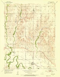
The Republican River carves a serpentine path through north-central Kansas, serving as the primary geographic anchor for a landscape defined by its emerging rail network and agricultural townships. This late nineteenth-century survey, conducted by Henry Gannett and R.M. Towson, reveals a region in the midst of a transport revolution. Seven distinct railroads, including the Atchison Topeka and Santa Fe Railway and the Union Pacific Railway, crisscross the plains to connect hubs like Concordia and Belleville.
Find a feature on this map
74 named features on this map. Tap any name to fly to it.
Don’t see what you’re looking for? This feature index may not catch every label — zoom into the map to look around manually.
Map Details
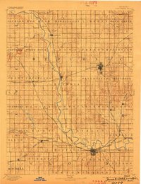
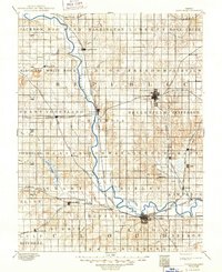
Editions of this 1892 Concordia Map
4 editions found
Other maps of this area

1891 · Clay Center
USGS Topo · 1:125,000

1892 · Concordia
USGS Topo · 1:125,000

1892 · Minneapolis
USGS Topo · 1:125,000

1893 · Washington
USGS Topo · 1:125,000

1894 · Mankato
USGS Topo · 1:125,000

1894 · Beloit
USGS Topo · 1:125,000

1898 · Superior
USGS Topo · 1:125,000

1898 · Hebron
USGS Topo · 1:125,000
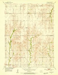
1953 · Glasco NE
USGS Topo · 1:24,000
1953 · Simpson
USGS Topo · 1:24,000