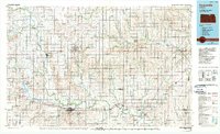
1985 Map of Concordia
USGS Topo · Published 1990About this map
The Republican River carves a winding path across north-central Kansas, anchoring a landscape defined by its agricultural townships and mid-century water management. In this 1985 survey, the importance of irrigation is evident in the complex network of the Courtland Canal and Scandia-Belleville Canal serving the western reaches of the quadrangle. Regional centers like Concordia and Belleville are connected by US Highway 81 and the Atchison Topeka and Santa Fe Railroad, which tracks the river valley toward smaller settlements such as Scandia and Clyde. Conservation and recreation areas are prominent, including the Jamestown State Wildlife Area near Salt Lake and the Washington State Fishing Lake and Wildlife Area to the east. The terrain is marked by distinctive features such as Twin Mounds, while the town-and-range system organizes the countryside into historic districts like Strawberry and Richland.
Find a feature on this map
117 named features on this map. Tap any name to fly to it.
Don’t see what you’re looking for? This feature index may not catch every label — zoom into the map to look around manually.
Map Details
Editions of this 1985 Concordia Map
2 editions found
Other maps of this area

1886 · Junction City
USGS Topo · 1:125,000

1889 · Marysville
USGS Topo · 1:125,000

1889 · Junction City
USGS Topo · 1:125,000

1891 · Clay Center
USGS Topo · 1:125,000

1892 · Concordia
USGS Topo · 1:125,000

1892 · Minneapolis
USGS Topo · 1:125,000

1893 · Washington
USGS Topo · 1:125,000

1894 · Junction City
USGS Topo · 1:125,000

1894 · Mankato
USGS Topo · 1:125,000

1894 · Marysville
USGS Topo · 1:125,000