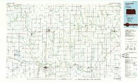
1985 Map of Concordia
USGS Topo · Published 1985About this map
The Republican River meanders across this North Central Kansas landscape, anchoring a network of agricultural communities connected by the Missouri Pacific Railroad, Santa Fe Railroad, and Union Pacific Railroad. This mid-1980s planimetric study highlights the regional significance of Concordia, where the Cloud County Comm College and Cloud County Hospital serve as local hubs. To the north, the Lovewell Reservoir and the Jamestown State Wildlife Area provide substantial public lands for water management and conservation.
Find a feature on this map
109 named features on this map. Tap any name to fly to it.
Don’t see what you’re looking for? This feature index may not catch every label — zoom into the map to look around manually.
Map Details
Editions of this 1985 Concordia Map
2 editions found
Other maps of this area

1886 · Junction City
USGS Topo · 1:125,000

1889 · Marysville
USGS Topo · 1:125,000

1889 · Junction City
USGS Topo · 1:125,000

1891 · Clay Center
USGS Topo · 1:125,000

1892 · Concordia
USGS Topo · 1:125,000

1892 · Minneapolis
USGS Topo · 1:125,000

1893 · Washington
USGS Topo · 1:125,000

1894 · Junction City
USGS Topo · 1:125,000

1894 · Mankato
USGS Topo · 1:125,000

1894 · Marysville
USGS Topo · 1:125,000