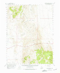
1960 Map of Conger Mountain
USGS Topo · Published 1975About this map
Conger Mountain dominates this West Desert landscape in Millard County, rising sharply above the basins and desert flats near the Nevada State Line. This 1960 survey highlights the complex topography of the Confusion Range, where water sources like Conger Spring and Conger Reservoir were critical anchors for livestock operations in an arid environment. The naming conventions throughout the quadrangle reflect a history of ranching and land use, from the high pastures of Horse Heaven and Little Horse Heaven to the seasonal camps at Sheepmens in Little Valley. A network of jeep trails and unimproved roads connects remote drainage systems like Kings Canyon and Boobs Canyon, illustrating the era's reliance on four-wheel-drive access for managing these high-desert rangelands.
Find a feature on this map
45 named features on this map. Tap any name to fly to it.
Don’t see what you’re looking for? This feature index may not catch every label — zoom into the map to look around manually.
Map Details
Editions of this 1960 Conger Mountain Map
2 editions found

Other maps of this area

1908 · Fish Springs
USGS Topo · 1:250,000

1910 · Fish Springs
USGS Topo · 1:250,000

1953 · Richfield
USGS Topo · 1:250,000

1953 · Delta
USGS Topo · 1:250,000

1958 · Richfield
USGS Topo · 1:250,000

1958 · Delta
USGS Topo · 1:250,000

1959 · Cowboy Pass
USGS Topo · 1:62,500

1960 · Notch Peak
USGS Topo · 1:62,500

1960 · Conger Range
USGS Topo · 1:62,500

1960 · Burbank Hills
USGS Topo · 1:62,500