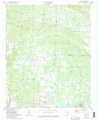
1974 Map of Congo
USGS Topo · Published 1984About this map
Avilla and the surrounding rural communities of Saline County define this landscape during the mid-1970s. The area is marked by a network of local roads connecting small settlements and family landmarks, such as Congo and Salem. The terrain is deeply intertwined with its water system, as the Saline River cuts through the southwest corner and Hurricane Creek meanders north to south. Near Big Ridge, industrial footprints appear in the form of multiple Quarries and a singular Quarry, suggesting the importance of local stone extraction to the regional economy.
Find a feature on this map
35 named features on this map. Tap any name to fly to it.
Don’t see what you’re looking for? This feature index may not catch every label — zoom into the map to look around manually.
Map Details
Editions of this 1974 Congo Map
3 editions found
Other maps of this area

1890 · Benton
USGS Topo · 1:125,000

1891 · Little Rock
USGS Topo · 1:125,000

1893 · Little Rock
USGS Topo · 1:125,000

1894 · Benton
USGS Topo · 1:125,000

1935 · Alexander
USGS Topo · 1:48,000

1938 · Benton
USGS Topo · 1:48,000

1941 · Alexander
USGS Topo · 1:62,500

1943 · Pinnacle Mtn
USGS Topo · 1:31,680

1944 · Benton
USGS Topo · 1:62,500

1944 · Alexander
USGS Topo · 1:31,680