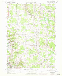
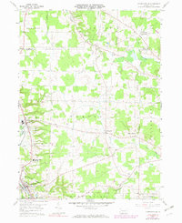
1959 Map of Conneautville
USGS Topo · Published 1972About this map
The borough of Conneautville anchors the southwest corner of this landscape, situated along the banks of Conneaut Creek as the valley transitions into the rising terrain of Summerhill. Further north, the village of Springboro and the settlement of Pageville reflect the rural distribution of the late 1950s, connected by the vital corridor of the Bessemer & Lake Erie railroad. This survey reveals a region defined by its watercourses and small-scale natural resource extraction, with numerous Gas Wells and Gas Wells appearing throughout the township lands.
Find a feature on this map
34 named features on this map. Tap any name to fly to it.
Don’t see what you’re looking for? This feature index may not catch every label — zoom into the map to look around manually.
Map Details
Editions of this 1959 Conneautville Map
6 editions found

Other maps of this area

1900 · Girard
USGS Topo · 1:62,500

1906 · Linesville
USGS Topo · 1:62,500

1908 · Linesville
USGS Topo · 1:62,500

1923 · Meadville
USGS Topo · 1:62,500

1923 · Cambridge Springs
USGS Topo · 1:62,500

1925 · Meadville
USGS Topo · 1:62,500

1925 · Cambridge Springs
USGS Topo · 1:62,500

1943 · Meadville
USGS Topo · 1:62,500

1943 · Cambridge Springs
USGS Topo · 1:62,500

1950 · Cleveland
USGS Topo · 1:250,000