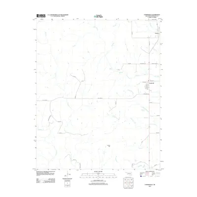
2012 Map of Connerville
USGS Topo · Published 2012About this map
Connerville and Pontotoc stand as the primary settlement hubs in this part of Johnston County, where the landscape is defined by the winding course of the Blue River and its numerous tributaries. The rural road network, including Mill Creek Rd and Indian Village Rd, connects isolated homesteads and local landmarks across the rolling terrain. Significant water sources like Tisdell Spring and Diamond Spring dot the countryside, highlighting the importance of groundwater in this Oklahoma ranching and agricultural region.
Find a feature on this map
45 named features on this map. Tap any name to fly to it.
Don’t see what you’re looking for? This feature index may not catch every label — zoom into the map to look around manually.
Map Details
Editions of this 2012 Connerville Map
This is the sole edition of this map. No revisions or reprints were ever made.
Other maps of this area

1901 · Stonewall
USGS Topo · 1:125,000

1901 · Tishomingo
USGS Topo · 1:125,000

1957 · Ardmore
USGS Topo · 1:250,000

1963 · Ardmore
USGS Topo · 1:250,000

1963 · Mill Creek
USGS Topo · 1:24,000

1963 · Troy
USGS Topo · 1:24,000
1966 · Harden City
USGS Topo · 1:24,000

1967 · Roff South
USGS Topo · 1:24,000

1967 · Connerville SE
USGS Topo · 1:24,000

1967 · Connerville
USGS Topo · 1:24,000