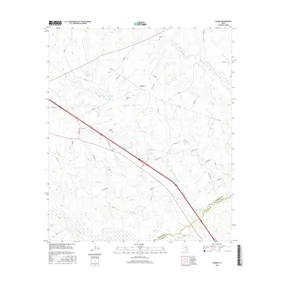
2016 Map of Connor
USGS Topo · Published 2016About this map
Connor sits as a central settlement in the Madison County countryside during the mid-2010s, defined by a network of farm-to-market roads and seasonal watercourses. The landscape is dotted with several family and local burial grounds, including Larrison Cem to the north and Burrows Cem near the center of the sheet. Interstate 45 cuts a prominent diagonal path through the terrain, flanked by I-45 SVC RD, which serves as a modern spine connecting rural properties to the larger regional corridor.
Find a feature on this map
56 named features on this map. Tap any name to fly to it.
Don’t see what you’re looking for? This feature index may not catch every label — zoom into the map to look around manually.
Map Details
Editions of this 2016 Connor Map
This is the sole edition of this map. No revisions or reprints were ever made.
Other maps of this area

1953 · Palestine
USGS Topo · 1:250,000

1954 · Beaumont
USGS Topo · 1:250,000

1957 · Beaumont
USGS Topo · 1:250,000

1957 · Palestine
USGS Topo · 1:250,000

1962 · Connor
USGS Topo · 1:24,000

1962 · Baker Lake
USGS Topo · 1:24,000

1963 · Bedias
USGS Topo · 1:24,000

1963 · Steep Branch
USGS Topo · 1:24,000

1963 · Crabbs Prairie
USGS Topo · 1:24,000

1963 · Madisonville
USGS Topo · 1:24,000