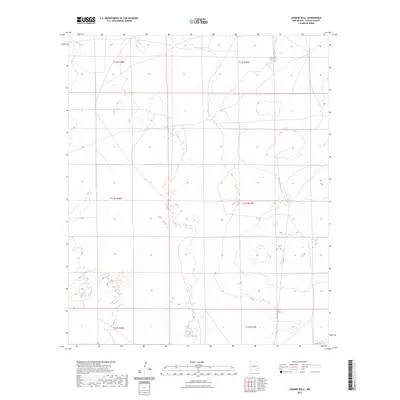
2023 Map of Connor Well
USGS Topo · Published 2023About this map
Arid Chaves County terrain defines the landscape of the Connor Well area, where the Public Land Survey System creates a rigid framework across the desert floor. This modern survey illustrates the enduring township and range structure, featuring segments such as T12s R28e and T13s R29e. The map reveals a sparse infrastructure typical of New Mexico's eastern plains, where long-established land divisions intersect with a limited road network. A single identifiable thoroughfare, Co Rd 165, provides access in the southeastern portion of the quadrangle, serving as a vital corridor for those navigating the wide-open ranching or mineral lands. The detailed contour lines and hydrography data from the National Elevation Dataset show the subtle drainage patterns and topography that have influenced land use in this section of the state for decades.
Find a feature on this map
7 named features on this map. Tap any name to fly to it.
Don’t see what you’re looking for? This feature index may not catch every label — zoom into the map to look around manually.
Map Details
Editions of this 2023 Connor Well Map
This is the sole edition of this map. No revisions or reprints were ever made.
Other maps of this area

1949 · Wade Ranch
USGS Topo · 1:24,000

1949 · Malstrom Ranch
USGS Topo · 1:24,000

1951 · Ninemile Well
USGS Topo · 1:24,000

1951 · King Camp
USGS Topo · 1:24,000

1952 · Connor Well
USGS Topo · 1:24,000

1952 · Bar C Bar Ranch
USGS Topo · 1:24,000

1954 · Brownfield
USGS Topo · 1:250,000

1955 · Roswell
USGS Topo · 1:250,000

1958 · Brownfield
USGS Topo · 1:250,000

1958 · Roswell
USGS Topo · 1:250,000