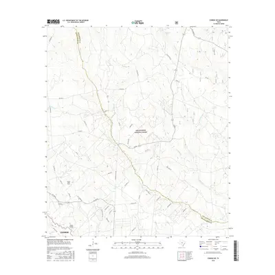
2016 Map of Conroe NE
USGS Topo · Published 2016About this map
Sam Houston National Forest dominates the landscape of this region northeast of Conroe, where dense pine and hardwood canopy give way to an intricate network of creeks and drainage basins. The boundary between San Jacinto Co and Montgomery Co follows the meandering course of Peach Creek, which serves as a central geographic artery for the area. Local history is anchored by Hickory Grove Cemetery and the small community of Steep Hollow, providing specific points of interest for genealogists and local researchers.
Find a feature on this map
52 named features on this map. Tap any name to fly to it.
Don’t see what you’re looking for? This feature index may not catch every label — zoom into the map to look around manually.
Map Details
Editions of this 2016 Conroe NE Map
This is the sole edition of this map. No revisions or reprints were ever made.
Other maps of this area

1954 · Beaumont
USGS Topo · 1:250,000

1957 · Beaumont
USGS Topo · 1:250,000

1958 · Conroe
USGS Topo · 1:24,000

1958 · Fostoria
USGS Topo · 1:24,000

1958 · Bear Creek
USGS Topo · 1:24,000

1959 · Cut and Shoot
USGS Topo · 1:24,000

1959 · Conroe NE
USGS Topo · 1:24,000

1960 · Willis
USGS Topo · 1:24,000

1960 · Maynard
USGS Topo · 1:24,000

1960 · New Waverly
USGS Topo · 1:24,000