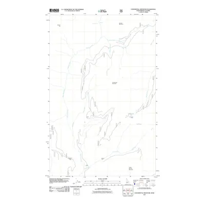
2011 Map of Continental Mountain
USGS Topo · Published 2011About this map
Continental Mountain and the surrounding high-altitude terrain of the Selkirk Mountains define this borderlands region between British Columbia and Idaho. The landscape is marked by the industrial history of the Continental Mine and McLean Mine, positioned among significant peaks such as Kaniksu Mountain and Snowy Top. Hydrological features dominate the drainage patterns, with the Upper Priest River winding through the valley, fed by tributaries like Rock Creek and Cedar Creek. Notably, the Upper Priest Falls and Waterfall labels indicate the dramatic elevation changes characteristic of this area. Accessibility into this remote mountainous territory is highlighted by Cabinet Pass and the winding Blue Joe Creek Rd, which provide passage through the steep geography. Small alpine water bodies, including Continental Lake and Trap Lake, are situated in the high basins between Green Bonnet Mountain and other nearby summits.
Find a feature on this map
20 named features on this map. Tap any name to fly to it.
Don’t see what you’re looking for? This feature index may not catch every label — zoom into the map to look around manually.
Map Details
Editions of this 2011 Continental Mountain Map
This is the sole edition of this map. No revisions or reprints were ever made.
Other maps of this area

1911 · Priest Lake
USGS Topo · 1:250,000

1913 · Priest Lake
USGS Topo · 1:250,000

1934 · Metaline
USGS Topo · 1:125,000

1942 · Metaline
USGS Topo · 1:125,000

1958 · Sandpoint
USGS Topo · 1:250,000

1963 · Sandpoint
USGS Topo · 1:250,000

1967 · Salmo Mtn.
USGS Topo · 1:24,000

1967 · Helmer Mtn
USGS Topo · 1:24,000
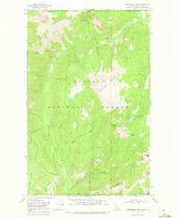
1968 · Continental Mtn
USGS Topo · 1:24,000

1969 · Grass Mountain
USGS Topo · 1:24,000