
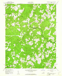
1942 Map of Contrary Creek
USGS Topo · Published 1942About this map
The North Anna River carves a winding path through the rural landscape of central Virginia, serving as the natural boundary between Spotsylvania and Louisa counties. During the early 1940s, this area remained largely agrarian, anchored by small crossroads settlements and community centers like Poindexters Store and the village of Centreville. The map captures a transition in topography near Contrary Creek, where the creek's namesake drainage system meets the river.
Find a feature on this map
17 named features on this map. Tap any name to fly to it.
Don’t see what you’re looking for? This feature index may not catch every label — zoom into the map to look around manually.
Map Details
Editions of this 1942 Contrary Creek Map
2 editions found
Other maps of this area

1887 · Spottsylvania
USGS Topo · 1:125,000

1890 · Goochland
USGS Topo · 1:125,000

1892 · Spottsylvania
USGS Topo · 1:125,000

1892 · Goochland
USGS Topo · 1:125,000

1942 · Mineral
USGS Topo · 1:31,680

1942 · Lahore
USGS Topo · 1:31,680

1942 · Partlow
USGS Topo · 1:31,680

1942 · Belmont
USGS Topo · 1:31,680

1942 · Brokenburg
USGS Topo · 1:31,680

1942 · Pendleton
USGS Topo · 1:24,000