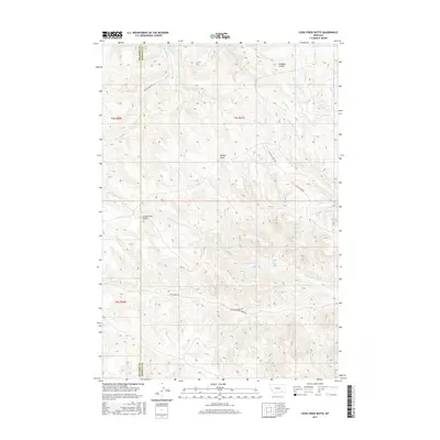
2017 Map of Cook Creek Butte
USGS Topo · Published 2017About this map
Buffalo Jump stands as a significant landmark in the central portion of this 2017 survey, overlooking a complex network of drainages in the Birney District. This high-plains landscape is defined by the divides between Cook Cr, Saint Johns Fork, and Wild Hog Cr, where the terrain transitions between Rosebud and Big Horn counties. The presence of Saint Johns Spring suggests the critical importance of water sources in this dry, dissected environment. Surveyed by the U.S. Geological Survey, the map documents the remote character of southeastern Montana where named features like Cook Creek Butte and Longjaw Coulee provide orientation for ranchers and land managers. The road system is limited to primary corridors like Muddy Creek Rd and Wild Hog Creek Rd, tracing the lower elevations of the major coulees and forks.
Find a feature on this map
20 named features on this map. Tap any name to fly to it.
Don’t see what you’re looking for? This feature index may not catch every label — zoom into the map to look around manually.
Map Details
Editions of this 2017 Cook Creek Butte Map
This is the sole edition of this map. No revisions or reprints were ever made.
Other maps of this area

1954 · Hardin
USGS Topo · 1:250,000

1957 · Hardin
USGS Topo · 1:250,000

1958 · Hardin
USGS Topo · 1:250,000

1958 · Painted Hill
USGS Topo · 1:24,000

1958 · Bull Creek Lookout
USGS Topo · 1:24,000

1958 · Fisher Butte
USGS Topo · 1:24,000

1958 · Lame Deer
USGS Topo · 1:24,000

1967 · Clubfoot Creek
USGS Topo · 1:24,000

1967 · Birney
USGS Topo · 1:24,000
1967 · Cook Creek Butte
USGS Topo · 1:24,000